
Trace a San Jose Street Address
Address research in San Jose works best as a chain. Begin with the exact situs address, meaning the physical location of the parcel, rather than a mailing address. The Santa Clara County Assessor can supply an address match, parcel number, and basic property facts. The county GIS map can then place that parcel beside the next one. Deeds add title parties, permits add a project timeline, and historical street indexes add listed occupants for selected years. Each record answers a narrower question, so a clean result keeps the source, date, and meaning beside every note.
Use the same bounded street segment each time. Record cross streets and the date searched, then move from the subject parcel to nearby parcels in a repeatable order. The sequence below keeps current property evidence, historical household clues, and restricted voter information from being treated as one undivided roster.
- Run the situs address through the Santa Clara Assessor property search. Accept the terms, save the APN, and note the jurisdiction, values, and parcel facts shown online.
- Open the Santa Clara GIS viewer. Find the polygon, record its APN and jurisdiction, then click the polygons that touch it.
- Use voter information only through the permitted self-service or statutory request route. The public self lookup authenticates the voter; it is not a tool for listing every person on a street.
- Take the title-changing document reference to the Clerk-Recorder, search the grantor and grantee names, and confirm each instrument with its legal description, date, and parcel clues.
- For past households, consult the California Room's street-order or reverse directories for a chosen year, then check the alphabetical entry for the spelling, occupation, and address.
The result is a street-by-street research trail, not a claim that every person connected with an address has been identified. The San Jose street directory is strongest when its address trail is dated and tied to a source, not treated as a complete roster.
San Jose Street Search Fields
The Santa Clara County Assessor search is the first address key in the workflow. Simple search accepts a property address. Advanced search separates the street number, direction, street name, street type, unit, and city. APN search accepts either eight digits without hyphens or the displayed hyphenated pattern. The terms checkbox must be accepted before Search will run.
The online roll does not offer owner-name or ZIP-wide browsing. Assessee identity is redacted from the Internet display. A situs address locates the taxable parcel, while a mailing address is where a notice goes, and the two can point to different places. For names and mailing details, use lawful inspection or a request through the Assessor office, not an assumption drawn from the web result.
| Search field | Mode | Required | Entry notes |
|---|---|---|---|
| Property address | Simple | Yes | Autocomplete situs address |
| Street Number | Advanced | With street | House or building number |
| Street Direction | Advanced | Optional | Choose the presented direction |
| Street Name | Advanced | With number | Situs street name |
| Street Type | Advanced | Optional | Street suffix dropdown |
| Unit | Advanced | Optional | Condominium or unit detail |
| City | Advanced | With street | Select the physical jurisdiction |
| APN Number | APN | Yes in APN mode | 12345678 or 123-45-678 |
| Terms acceptance | All modes | Yes | Required before Search |
At least one street-name character is accepted in the advanced search, punctuation is omitted, and numbered streets use forms such as “1st.” Condominium research can begin without the unit so the broader parcel list can be browsed. Select the physical city, not only the preferred postal city.
San Jose Street Parcel Records
The Santa Clara County interactive map viewer places a San Jose address in its surrounding parcel and jurisdiction pattern. Search or pan to the location, zoom until parcel lines appear, click the subject polygon, and keep the popup open long enough to record the APN and jurisdiction. Close or retain that popup before selecting each touching polygon. Consecutive parcel numbers are not proof of physical adjacency.
Turn on one layer at a time. Parcel boundaries show the land unit, jurisdiction layers help separate city and county contexts, and aerial context can explain a rear parcel or an irregular lot. A radius is not needed for an immediate block when the map extent and touching polygons define the search. The county's open parcel dataset provides map, table, and export views, but the county warns that GIS is supplied “as is” and must be checked against primary records.
GIS is useful for parcel research because it catches flag lots, rear parcels, condominium parcels, and gaps that a simple list can miss. It is a discovery aid. The assessment roll and recorded instrument remain the stronger sources for property facts and title.
The county GIS source shown here is the practical starting point for adjacent-parcel browsing.
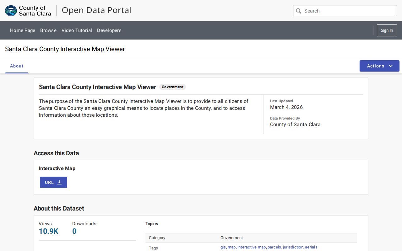
After the map sweep, each APN can be checked against the Assessor and the appropriate record custodian. The map does not by itself identify a household.
San Jose Street Directory Records
Address-keyed sources overlap, but they do not carry the same kind of evidence. The San Jose street directory becomes more useful when each record is labeled as parcel data, title data, project data, voter information, or a historical listing. The table keeps those roles distinct and shows the access channel that fits each source.
| Record set | Keeper | Street-level yield | Access |
|---|---|---|---|
| Assessment roll | Santa Clara Assessor | Situs, APN, values, characteristics | Free address or APN web facts; office fallback |
| GIS parcels | Santa Clara County and city map services | Parcel sequence, jurisdiction, adjacent polygons | Free viewer, table, and export |
| Recorded instruments | Santa Clara Clerk-Recorder | Grantor, grantee, date, legal description | Workstations, request, or paid copy |
| Voter information | California and Santa Clara election offices | Restricted residence information for permitted uses | Self lookup or statutory request |
| Permits and inspections | San Jose Planning, Building and Code Enforcement | Project history, status, dates, images | Free public web search |
| Reverse directories | King Library California Room | Listed occupant or subscriber by street and number | In-library historical research |
The APN is the bridge between the Assessor, GIS, and recorded deeds. The street name helps locate a directory entry, but the Recorder indexes instruments by document number, date, type, class, and grantor or grantee. That is why an address-first search must become a parcel-and-party search before an ownership claim is made.
For a current street sweep, save the source date and the exact field used. For historical work, save the directory year and the page or street index entry. An address record assembled without those notes can blur a mailing address, a project participant, and a listed resident.
San Jose Street Permit Records
The San Jose SJPermits public search is the city's strongest address-to-project evidence source. It requires no login and offers map search, address search, APN search, permit-number search, project-reference search, and tract-number search. An address or APN result can show the project or permit number, type, description, status, dates, applicant or contractor references, inspection history, and linked images. Those fields can date an alteration or explain a building change in the address record.
Search by address first, then repeat by APN when the result set is broad. Record permit or reference numbers, the description, status, dates, inspection entries, and whether images are available. Applicant or contractor names show involvement with a project, not residence. Code Enforcement is a separate public inquiry for active and closed cases from the past two years by address or case number. Its result can show the status, inspector, service-area manager, council district, and case number, while the detail describes an alleged violation. An allegation is not a confirmed finding.
The San Jose permit and property search demonstrates how an address can reveal imaged inspections, tract maps, plans, and certificates of occupancy.
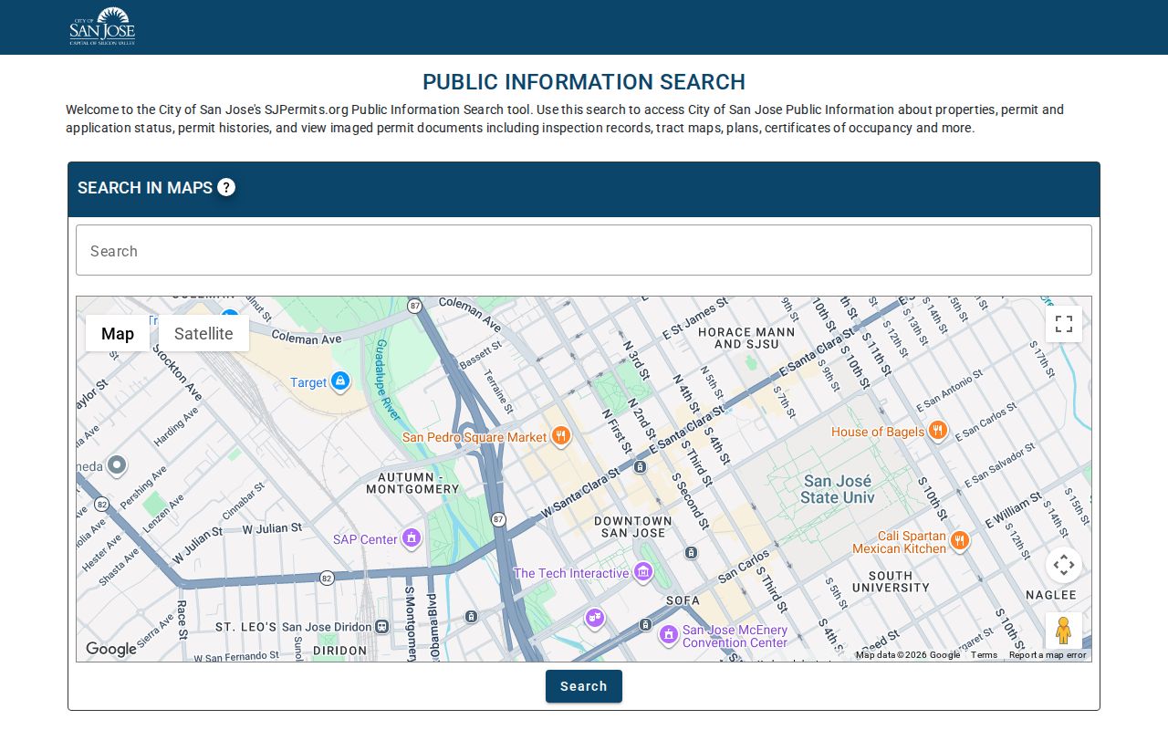
Permit evidence is strongest when paired with the APN and a dated map. It can show when a structure changed, while the directory or census layer supplies the historical people clue.
San Jose Street Deed Records
A deed chain begins after the address has been resolved to an APN and legal parcel description. The Santa Clara Clerk-Recorder at 110 W. Tasman Drive, First Floor, is the custodian for recorded documents. The office indexes by parties and document identifiers, not by street address. A lawful roll inspection or Recorder reference supplies the current vesting deed, the document that places present title in a named party. The seller on that deed is the earlier grantor to investigate.
The Recorder's research instructions describe the counter and index process. Digital Reel access covers 1850 to 1980, while public workstations cover 1981 to the present. Before May 1, 1995, book and page can identify an instrument. Later records use a recorder serial, document, or instrument number.
- Write down the APN, legal description, current vesting deed reference, and the parcel or subdivision name.
- Read the current purchase deed and identify the seller as the prior grantor, keeping the recording date beside the name.
- Search that seller as an earlier grantee, constrain the date and document type, and compare the legal description and APN.
- Repeat backward, checking spouse or trust names, parcel history, and chronology whenever a name appears more than once.
- When the accessible index ends, request older grantor and grantee books, deed books, maps, or cataloged microfilm through the Recorder or archives.
Official documents cannot be purchased online or emailed. Copies cost $4 for the first page and $2 for each additional page; certification adds $2 per document and requires every page. Email orders use physical-mail delivery and a $6 card fee. In-person card payment has a $2.50 fee. Checks and money orders are accepted, processing can take seven business days, and delivery is by USPS or prepaid UPS.
The Santa Clara parcel dataset supplies map and table context before a recorded instrument is checked.
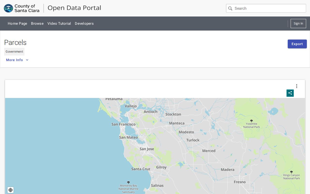
A copy is documentary evidence of the instrument. GIS outlines and directory listings are leads. Never join two deeds only because the party names look alike.
San Jose Street Renumbering in 1913
Address continuity can fail even when a building stands in the same place. San Jose's Fourteenth Street became Seventeenth Street in 1913. The California Room maintains a street-name-change list, and old maps, directory indexes, and parcel descriptions can preserve the link between the former and later names. A search that treats every printed number as permanent can create a false move or place a household on the wrong block.
Check direction, suffix, subdivision, annexation, and house-number changes before comparing two years. The city directory shelf contains surname-order and street-order material, while Sanborn maps and county map books can show the physical street context. Use the legal description and parcel history when the street label is uncertain. The map-book index covers recorded maps from about 1850 to 1957 and includes roads, cities, survey dates, and recording dates.
Street renumbering is a small San Jose detail with a large effect on address research. It explains why an old address may vanish from a direct search while the structure remains in the same historical trail.
Reverse Directories for San Jose Streets
Reverse or criss-cross directories put the street and number first. Haines and Pacific Bell reverse directories begin in the mid-1960s and extend the address-first trail beyond the end of the San Jose city-directory run in 1979. The California Room holds these shelves for in-person work, including surrounding cities and unincorporated places. Choose a year, find the street in the reverse section, copy the listed name or subscriber, and then turn to the alphabetical entry for more context.
The San Jose Public Library house-history guide connects directories with permits, maps, newspapers, and other local sources. A directory may omit a household member, a non-subscriber, or a year with publication gaps. It can place a name at a door, but it cannot by itself establish title or prove that every person at the address was listed.
The house-history source guide used for San Jose street research shows why a directory entry should be paired with a map, deed, or dated permit.
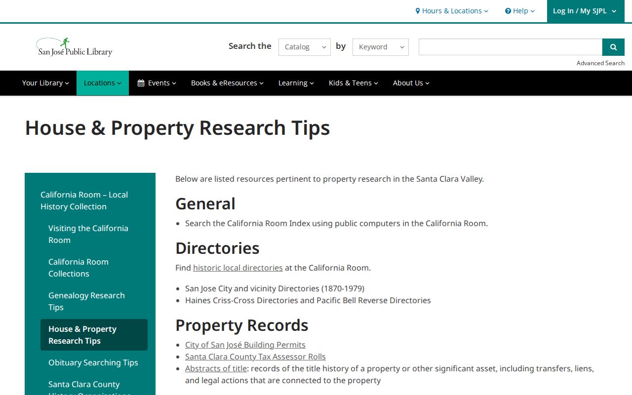
For older households, the alphabetical entry, street index, newspaper notice, and census schedule work best as a group. The San Jose Directory Book carries the collection details and reading method.
San Jose Street ZIP Records
A postal label is not a city-limit test. USPS assigns ZIP routes for delivery, and “San Jose, CA” can appear outside the municipal boundary. San Jose parcels can also sit near Santa Clara, Campbell, Cupertino, Milpitas, or county-island edges. For address research, test the delivery label, physical jurisdiction, and APN as three separate fields.
ZIP 95140 reaches Mount Hamilton county territory and is the clearest mismatch between postal San Jose and city limits. The city-limit GIS result includes 95002, 95008, 95013, 95032, 95037, and 95192, even though those codes are not all ordinary San Jose residential labels. ZIP 95192 is an institutional code. A ZIP can describe delivery geography, not a neighborhood roster or a resident count.
The San Jose ZIP boundary layer can be compared with the parcel and city-limit layers. Verify the exact address through USPS, then use GIS for jurisdiction and the Assessor for situs and APN. The Assessor's advanced search has a City field but no ZIP-wide mode, and SJPermits searches by address or APN rather than by ZIP.
Limits of the San Jose Street Directory
An address directory cannot show every person connected with a parcel. Online assessment results suppress assessee identity. A deed identifies parties to an instrument, not every household member. A permit identifies a project participant, not a resident. Historical directories show listed occupants or subscribers for a particular edition, while the voter file is limited by statutory access rules. DMV address data is restricted by the federal Driver's Privacy Protection Act, and utility customer lists are not public street records.
Use a source that fits the question. Parcel and deed records support property history. SJPermits supports construction history. Directories and census schedules support historical household clues. Official election tools support a voter's own status, not an open street enumeration. When a source stops, a narrow records request or an in-person archive visit is more accurate than a guess.
- Parcel
- A mapped land unit identified in county records, usually by APN.
- Situs address
- The physical address used to locate the taxable property.
- Plat
- A recorded map that lays out lots, streets, and parcel lines.
- Criss-cross directory
- An address-order directory that starts with a street and number, then names a listed occupant or subscriber.
Lawful personal use. San Jose street and address records support family history, house history, reconnecting, and civic research. Do not use a record to stalk, harass, intimidate, or harm any person.